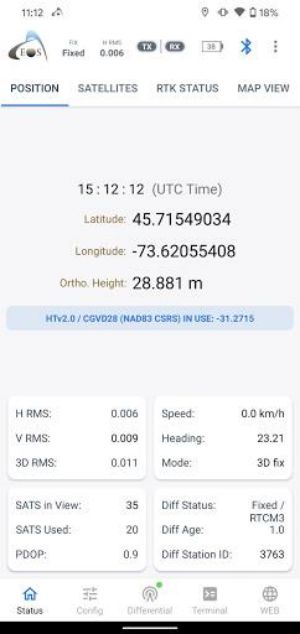
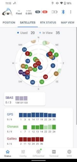
Eos Tools Pro is a powerful monitoring utility specifically designed for the Arrow Series High-Precision GPS / GNSS receivers from Eos Positioning Systems. This app is a must-have for professionals in the GIS and surveying industry who require submeter and centimeter accuracy. With Eos Tools Pro, users can access crucial GNSS information such as RMS values, PDOP, Differential Status, and Satellites Tracked and Used. The built-in NTRIP client allows users to connect to an RTK Network for real-time correction, and the app also offers user-configurable alarms for added convenience. Additionally, Eos Tools Pro features an integrated browser for running HTML5 apps and provides support and sample codes for programmers. However, please note that the app requires an Arrow GNSS receiver to function properly and may decrease the battery life of your device. Get Eos Tools Pro now and experience the ultimate monitoring utility for your GPS / GNSS receiver!
Features of Eos Tools Pro:
- Advanced GNSS Information: The app provides important GNSS data such as RMS values, PDOP, Differential Status, and Satellites Tracked and Used. These details are crucial for accurate submeter and centimeter GIS and Surveying data collection.
- Built-in NTRIP Client: The app includes a built-in NTRIP client that allows users to connect to an RTK Network. This enables access to RTK or DGNSS correction, enhancing the accuracy of positioning.
- Satellite View: Users can view all constellations in use, including GPS, Glonass, Beidou, Galileo, and QZSS. This feature provides a comprehensive view of satellite positioning.
- Location Extras: The app passes on valuable GNSS metadata to the Location Service via Mock Provider. This improves location accuracy and enhances overall performance.
- User Configurable Alarms: Eos Tools Pro allows users to customize audible alarms according to their preferences. This feature ensures that users are alerted to important events or changes in GNSS status.
- Terminal Emulator and Integrated Browser: The app features a terminal emulator that enables users to send configuration commands to the receiver. Additionally, it offers an integrated browser for running HTML5 apps.
Conclusion:
With its advanced GNSS information, built-in NTRIP client, satellite view, location extras, user configurable alarms, and terminal emulator with an integrated browser, this app enhances the accuracy and efficiency of GIS and Surveying data collection. Whether you're a professional surveyor or a GIS enthusiast, it is a must-have tool to optimize your GPS positioning. Click now to download and experience the power of precise data collection.


